
 English
 中文

Bulletin
CropWatch bulletinMenu
Authors: lirui | Edit: Miao
2.2.1 Abnormal temperature
According to the remote sensing monitoring of farmland land surface temperature by CropWatch, rare climate anomalies have occurred in many parts of the world. Among these affected areas, the major corn and soybean producing regions in North America— which play a crucial role in global food supply— as well as some corn and potato planting belts in northern Eastern Europe and Western Asia, are facing a high-temperature stress risk of at least a once-in-five-year magnitude. This has exerted a certain impact on the growth and development of local crops and the stability of their yields.
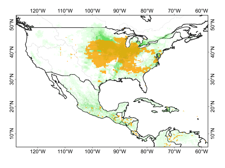

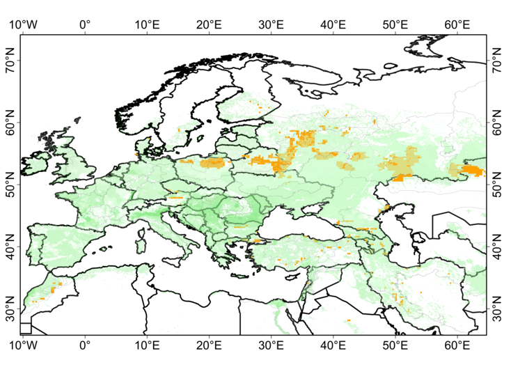
a b
Figure 2.14 High-Temperature Risk in North America and Mid-to-High Latitude Regions, July 2025
(a, High-Temperature Risk (Return period: Five-Years or Above) for maize and Soybeans in North America; b, High-Temperature Risk (Return period: Five-Years or Above) for maize and Potatoes in Eastern Europe and Western Asia)
2.2.2 Flood water-logging
In July 2025, the precipitation centers in Eastern Asia were concentrated in central-northern India, the coastal areas of Myanmar, eastern Thailand, the Philippines, the northeastern part of the Haihe River Basin, and the west coast of the Korean Peninsula. Monitoring data from CropWatch indicates that in the late July, the growth conditions in central India, the northeastern Haihe River Basin of China, and the Philippines were weaker than those in previous years. The soil moisture in the upper reaches of the Narmada River in India has reached a saturated state; additionally, analysis based on the Vegetation Condition Index (VCI) reveals that the vegetation growth in this region is poor, and waterlogging has exerted a significant adverse impact on the crop growth environment in these areas.
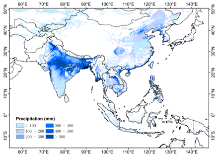

(a) July Precipitation (CHIRPS, 5km) (b) VHP VCI 2025030 (NOAA Satellite, 4km)
Figure 2.15 Precipitation in July 2025 and Late-July Vegetation Condition Index (VCI) in Eastern Asia


Sentinel-1 (2025/07/25) Terra MODIS (2025209)
Figure 2.16 VV Image of the Narmada River Reach in India (July 25, 2025) and VCI of MODIS 250m Resolution
2.2.3 Lower Water Levels in Reservoirs in Africa and West Asia
CropWatch's monitoring of reservoir water surfaces in July 2025 shows that the water surface areas of Keban Baraji in Turkey, Razazah in Iraq, M'Bakaou in Cameroon, and Roseires Reservoir in Sudan, which are located in Africa and West Asia, are all at low levels in the same period during recent years. This has led to a shortage of irrigation water supply in the region, and relevant countries need to initiate drought prevention plans as soon as possible to reduce the potential impacts of water shortage on agricultural production and the ecological environment.
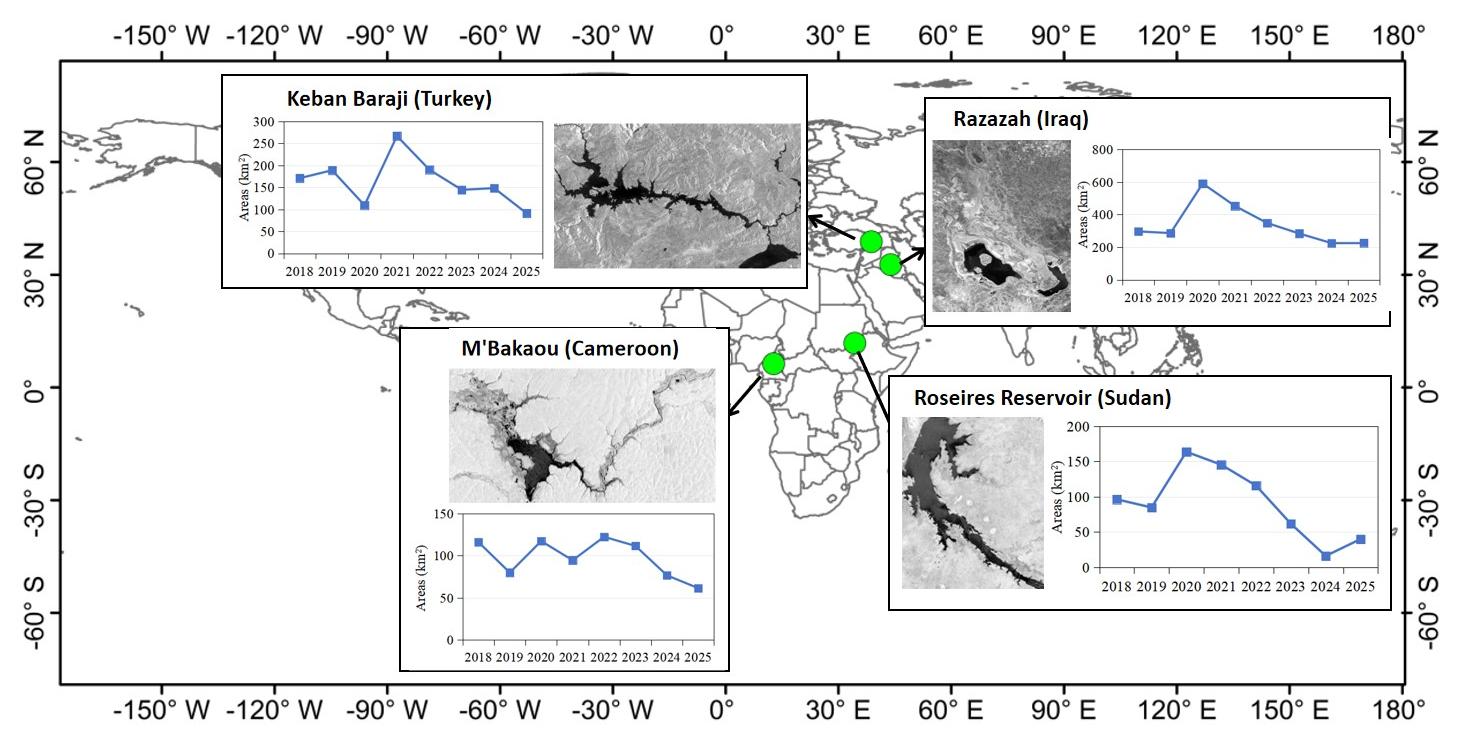
Figure 2.17 Remote Sensing Monitoring of Water Surface Areas of Typical Reservoirs in Africa and West Asia, July 2025